A hazardous winter storm warning has been issued for nine counties in New York, bringing heavy snowfall, high wind gusts, and dangerous travel conditions to many parts of the state.
The National Weather Service (NWS) issued the alerts Saturday morning, and they will remain in force until late morning or early afternoon, depending on the area.
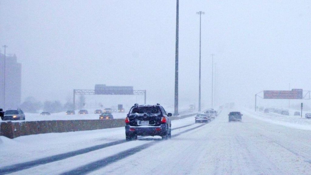
Forecasters warn that blowing snow, poor visibility, and fast-accumulating precipitation could cause major delays for motorists, especially in higher elevations and around the eastern Lake Ontario area.
Heavy Snow and Strong Winds Expected
This Article Includes
Meteorologists predict that various sections of the state may have substantial snowfall combined with strong gusts, increasing the possibility of whiteout conditions.
The most significant precipitation is forecast in Oswego, Jefferson, and Lewis counties, where an additional 6 to 12 inches of snow may fall before the warning expires around 2 p.m. ET. Winds in the region can gust up to 40 mph, resulting in extensive blowing snow.
According to the National Weather Service Buffalo office, snowfall rates can be heavy at times on mountainous areas.
“Heavy snow and gusty winds will produce areas of blowing snow and difficult travel conditions across the eastern Lake Ontario region, especially near the Tug Hill Plateau,” the agency warned in its winter weather advisory.
Communities like as Watertown, Oswego, and Lowville are predicted to get significantly lesser totals of 3 to 5 inches, however strong gusts may still pose dangerous driving conditions.
Western New York Facing Blowing Snow
The warning continues in place in Wyoming, Cattaraugus, and southern Erie counties until 11 a.m. EDT, with another 1 to 3 inches of snow expected.
However, wind is a significant threat in these places. Gusts up to 55 mph could cause drifting snow and significantly decreased visibility, sometimes going below a quarter mile.
Higher elevations, notably Wyoming County’s ridgetops, are predicted to have the most snowfall. Lower locations, including sections of the Buffalo Southtowns, may see smaller accumulations, but the roads remain treacherous and visibility is reduced.
Authorities warn that even minor snowfall combined with strong gusts might quickly result in disastrous traffic conditions.
Adirondacks and Central New York Also Impacted
The storm is also affecting sections of the Adirondack region, including Hamilton and northern Herkimer counties, where an additional 2 to 4 inches of snow are expected before the warning expires early Saturday afternoon.
Forecasters predict that snowfall rates might exceed 1 inch per hour at times, temporarily lowering visibility to less than half a mile.
Further west in northern Oneida County, including the town of Boonville, another 2 to 5 inches of snow is forecast, along with wind gusts of up to 40 mph. Weather officials warn that travel in the area could become extremely difficult.
Travel Safety Warnings Issued
Emergency officials are encouraging residents to avoid needless travel while the storm continues, especially in higher elevations where circumstances may deteriorate quickly.
The National Weather Service warned drivers to plan for emergencies if travel is essential.
“If you must travel, keep an extra flashlight, food, and water in your vehicle in case of an emergency,” according to the government.
Drivers in New York can check current road conditions by dialing 511, the state’s official transportation information service.