Just in time to meddle with Halloween decorations, a powerful storm is expected to hit parts of New Jersey, Pennsylvania, Delaware, and New York with strong winds, heavy rain, and dangerous surf along the shore. The National Weather Service has started issuing advisories for the region in response to the concerns, aiming to prepare residents for the storm.
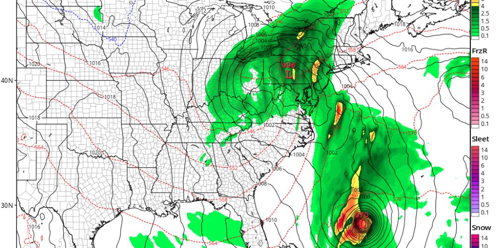
A variety of weather features on the map will interact to create circumstances favorable for a storm to hit parts of the Mid-Atlantic. While Hurricane Melissa advances over the Bahamas toward Bermuda, a weak area of low pressure near the Carolinas continues to meander, causing some very light showers along the coast and inland in Delmarva and South Jersey. That weak region of low pressure will combine with a larger low over the Tennessee River Valley and move northeastward toward New Jersey tonight. While this system helps to push Melissa towards Bermuda and away from the East Coast of the United States, it also allows for a more widespread band of rain to develop from southwest to northeast after midnight.
Rain will persist until midday before gradually clearing from the southwest in the early afternoon to the northeast in the mid- to late evening. The National Weather Service says flooding worries are minor given how dry this area has been. However, some of the forecast tools they employ show a tiny likelihood of 1 inch per hour rainfall rates, which might produce isolated flood concerns. The vast bulk of the area will get only beneficial rain; however, if the strongest rates fall over the urban corridor, there may be flooding. Rainfall is forecast to range from 1 to 3 inches, with the majority falling between 6 and 12 hours.
The National Weather Service predicts strong wind and tornadoes in regions south of I-195 and the Pennsylvania Turnpike, based on the low’s expected course.
Winds outside of thunderstorms will be fairly strong, particularly along the coast. A strong, low-level jet will be close to the surface, potentially causing gusts of 40–50 mph. Aside from interfering with Halloween decorations, high winds may also take down tree branches and wires, resulting in power outages. As a result, the wind advisory was issued for the New Jersey coastal counties of Monmouth, Ocean, Burlington, Atlantic, and Cape May, as well as the Delaware Beaches. The Wind Advisory will last most of Thursday. Away from the coast, winds will remain brisk, with gusts reaching up to 40 mph.
The low pressure will move into northern New England by Friday morning and leave Friday night. Showers will end after midnight Thursday night, and a tight pressure gradient between the departing low- and high-pressure systems will form over the Northern and Central Plains on Friday. This type of atmospheric setup will produce west-to-northwest winds of 20 to 25 mph with gusts of 35 to 40 mph across much of the area, with gusts of up to 50 mph likely for the Jersey and Delaware beaches. Winds will decrease Friday night when the pressure gradient eases.
Wave heights will reach 10-12 feet along much of the NJ coast, with smaller levels along Delaware Bay coasts. There may be some mild to severe coastal flooding at these sites, but conditions should be significantly improved from when the latest nor’easter passed through. Nonetheless, a Coastal Flood Advisory has been issued for Sussex, Delaware; Cape May, Atlantic, and Burlington counties in New Jersey; and Queens, Suffolk, and Nassau counties in New York. A Coastal Flood Advisory is also in force along the coast of southern Fairfield County, Connecticut, and southern Westchester County, New York.