A fast-moving Alberta clipper storm is expected to sweep through the Northeast this weekend.
It will bring a wintry combination of snow, sleet, freezing rain, and strong winds, potentially causing hazardous travel conditions across upstate New York and northern New England.
Related posts


The storm is forecast to arrive late Saturday, Nov. 15, and last until Sunday morning, Nov. 16, with the worst effects felt overnight.
Icy weather and hazardous travel are expected in northeastern New York and northern New England Saturday night, Nov. 15, through Sunday morning, Nov. 16.
According to the National Weather Service, colder air from Canada will fuel the system, causing bursts of snowy precipitation. Other parts of the Northeast can expect rain and showers throughout that time range.
The Adirondacks and southern Green Mountains are expected to receive freezing rain early Saturday evening before the storm converts to rain around midnight. Elsewhere in the Northeast, widespread rain is forecast, with snow showers possible in higher elevations.
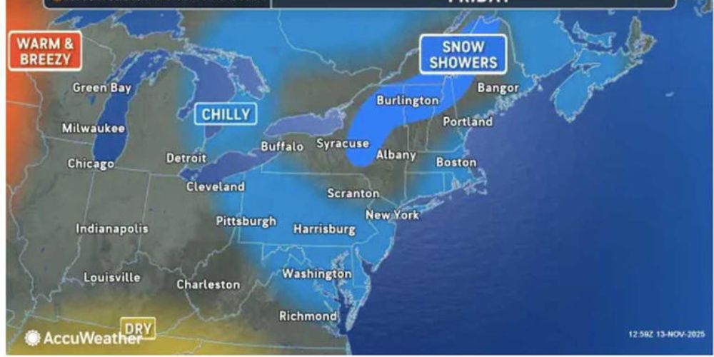
Snow flurries and light snow showers are possible ahead of the storm on Friday night, Nov. 14, over the region, although accumulations are predicted to be minor.
Following the clipper system, colder air and stronger winds will sweep over the region Sunday and early next week.
AccuWeather experts predict that rain showers will turn into snow showers in Ohio, West Virginia, Pennsylvania, and New York, with lake-effect snow developing Sunday through Monday, November 17.
On Sunday, November 16, lingering cold air will cause a combination of rain and snow in places shown in pink, as well as snow showers in areas shown in light blue.
Northeastern Ohio, northwestern Pennsylvania, and sections of western and northeastern New York may receive several inches of snow if snow bands persist.
Windchill values will be 10 to 20 degrees lower than actual temperatures due to the strong winds, with highs ranging from the 30s and 40s inland to the lower 50s along the shore.
This storm follows a normal seasonal trend for clipper systems, which produce fast-moving bursts of severe weather but little precipitation.
While temperatures are anticipated to remain 5 to 10 degrees below average for parts of next week, conditions will be milder than earlier this month, when the region endured a more severe cold snap.
Motorists in areas anticipating freezing rain or snow should use caution, as roads may become hazardous, particularly overnight Saturday and Sunday.


