Long-range weather forecast models are predicting an increase in severe weather danger throughout sections of Texas and adjacent states as December nears its end, prompting early fears about an unusually timed storm.
According to extended-range model data, the best window for structured storms appears to be between December 20 and December 23, with some signals arriving as early as December 18.
Related posts
This Article Includes
- 0.1 Related posts
- 0.2 Winter Storm Warnings Issued for 11 States As Dangerous Snow Conditions Emerge
- 0.3 Severe Storms Will Strike Texas With Hail, Tornado And Flood Threats
- 1 Why Forecasters Are Paying Close Attention
- 2 Atmospheric Setup Behind the Risk
- 3 Areas Most Likely to Be Impacted
- 4 Why the Timing Is Notable


Why Forecasters Are Paying Close Attention
According to extended-range model data, the best window for structured storms appears to be between December 20 and December 23, with some signals arriving as early as December 18.
“Long-range forecast models are hinting at an uptick in severe weather potential,” meteorologist Paul Dorian noted while reviewing the pattern.
While confidence remains low at this distance, analysts believe the frequent recurrence of this signal is sufficient to merit early observation.
Atmospheric Setup Behind the Risk
The predicted pattern indicates a significant conflict between warm, moisture-rich air from the Gulf of Mexico and impending upper-level disturbances moving in from the west.
This type of configuration is known to support:
- Strong to severe thunderstorms
- Damaging straight-line winds
- Large hail
- A conditional tornado threat
“It’s not a guarantee of severe weather, but the ingredients are beginning to line up,” forecasters caution.
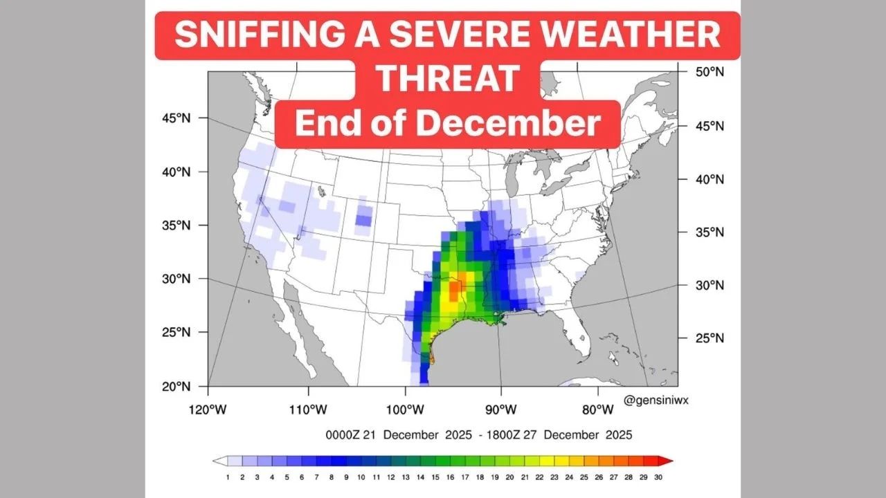
Areas Most Likely to Be Impacted
Based on the model guidance presented in the provided data, the key areas of concern now include:
- Texas
- Oklahoma
- Arkansas
- Louisiana
The strongest signal is concentrated along the Lower Mississippi River Valley, where instability and wind shear may converge most effectively if the trend persists.
Why the Timing Is Notable
Severe weather events do occur in December, although they are less common, increasing the risk owing to a lack of public knowledge and preparedness.
“Late-season severe weather can catch people off guard,” meteorologists warn, emphasizing the importance of early awareness.


