A renewed surge of arctic cold air is expected to sweep into central and eastern states on Thursday, creating conditions capable of producing isolated severe thunderstorms across portions of Illinois, Tennessee, Mississippi, and Alabama. Forecasters believe the main hazard will be severe wind gusts as moisture and storm activity surge north ahead of the sharp cold front.
Cold Front Ignites Limited but Strong Storm Potential
This Article Includes
Meteorologists say that while overall moisture and instability will be limited, the dynamics of this system are strong enough to support a few isolated severe storms Thursday afternoon and evening.
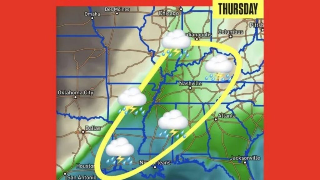
The emphasized risk zone extends from eastern Illinois to Indiana, Kentucky, Tennessee, Mississippi, Alabama, and parts of the Southeast. Storms that occur may create brief downpours, lightning, and wind gusts, all of which can cause localized damage.
Damaging Winds Remain the Main Hazard
According to forecast data, the primary risk is high straight-line winds, which may affect travel and outdoor structures. The storm setup does not currently indicate a broad severe outbreak, but forecasters warn that even isolated storms can cause dangerous wind bursts.
The forecast map’s yellow-outlined zone, which includes Nashville, Memphis, Birmingham, Jackson, and areas of southern Illinois, should be closely monitored.
Temperature Swings Expected Behind the Front
Once the storms move east, the arctic air mass will cause dramatic temperature reductions, bringing an end to the spring-like warmth that surged north earlier this week. Many locations in the Midwest and South may experience temperature changes of 20-30 degrees during a 24-hour period.