The National Weather Service (NWS) has issued winter storm warnings for five states, with severe conditions forecast in some places.
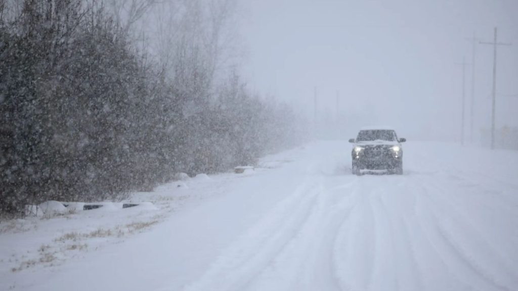
Forecasters predict that powerful winter systems will deliver up to three feet of snow, whiteout conditions, and damaging winds through Saturday. NWS bulletins frequently mention hazardous travel and potential consequences on utilities and infrastructure.
The alerts signal the possibility of life-threatening weather, particularly at higher elevations and near key mountain passes. The NWS warns that extremely heavy snow, along with strong gusts and blowing ice, may cause impassable roads, significant transportation disruptions, power outages, and an increased avalanche danger.
Several affected locations, including critical interstate highways and popular recreation spots, are coming as the holiday season approaches, raising concerns about preparedness and emergency response.
States Under Winter Storm Warnings
This Article Includes
Washington
Multiple warnings advisories have been issued, including Snoqualmie Pass, Stevens Pass, and Mount Rainier. Heavy snowfall is forecast, with totals ranging between one and three feet—highest at higher elevations like Paradise and Mount Baker. Warnings are in effect from 4 a.m. Friday until 4 p.m. PST Saturday, with severe travel conditions expected.
Oregon
The east slopes of the Oregon Cascades, including Sisters and Sunriver, are under a winter storm warning. The forecast snowfall ranged from six to ten inches, beginning at 4 a.m. PST Friday and lasting until 10 a.m. PST Saturday. Drivers are urged to avoid travel due to slick roads and the possibility of fallen trees.
Idaho
Mountain areas such as the Sawtooth/Stanley Basin and Sun Valley could receive one to two feet of snow over 7,000 feet, with wind gusts up to 45 mph. Lower elevations below 7,000 feet may still receive several inches, including perhaps five to eight inches in Stanley and Ketchum. The warning is in force until 5 a.m. MST Saturday, with backcountry travel predicted to be “very difficult to impossible.”
Montana
Warnings apply to the Absaroka/Beartooth and Bitterroot/Sapphire Mountains. Snow accumulations may range from eight to 14 inches at Lolo Pass to 16-24 inches at Lost Trail Pass, with winds gusting up to 45 mph and a growing avalanche risk. Alerts will remain in effect until 5 p.m. MST Friday, with substantial disruptions expected on mountain passes. The NWS also cautions that strong winds might knock down trees and cause power disruptions.
Wyoming
The most severe weather is forecast in Wyoming’s mountain ranges, which include Yellowstone, the Tetons, and the Wind River Range. Two to three feet of snow is probable, with isolated totals exceeding three feet, with wind gusts up to 55 mph. Warnings are in effect until 5 a.m. MST Saturday. Backcountry travel is not recommended due to the likelihood of blowing and drifting snow.
Additional Winter Weather Advisories
Mid-Atlantic
Garrett County, Maryland, and sections of West Virginia may receive two to four inches of snow with winds gusting up to 60 mph from 10 a.m. to 10 p.m. EST Friday, potentially disrupting evening travel.
Great Lakes Region
Advisories in Michigan, Wisconsin, and Minnesota warn of slick roads, blowing snow, and the possibility of flash freeze. Northern Lower Michigan could get up to four inches of snow and wind gusts near 45 mph through Friday afternoon. Advisories for northern Wisconsin and Minnesota are set to expire early Friday.
New York and Pennsylvania
Lake-effect snow could deliver three to six inches to western New York and northwest Pennsylvania, with gusts reaching 45 mph. Hazardous circumstances are possible during the evening commute. Advisories are valid from late Friday morning to early Saturday.
Pacific Northwest
In addition to winter storm warnings, Washington and Oregon advisories predict six to sixteen inches of snow above 2,500-3,000 feet, with gusts reaching 40 mph from early Friday to Saturday morning.
Northern Rockies
Lemhi County in Idaho and Montana’s Continental Divide may receive six to twelve inches of snow near passes and up to twenty inches in higher areas, with gusts up to 55 mph. Advisories are live until Friday evening.
Wyoming (Additional Areas)
Jackson Hole, Star Valley, and the Upper Green River Basin Foothills may receive four to 14 inches of snow with gusts up to 45 mph through Saturday morning, worsening already dangerous conditions.
What Happens Next
Storms are predicted to linger in most places until Saturday morning. Officials in affected areas encourage residents to prepare for rapidly changing conditions and use extreme caution, particularly when traveling.