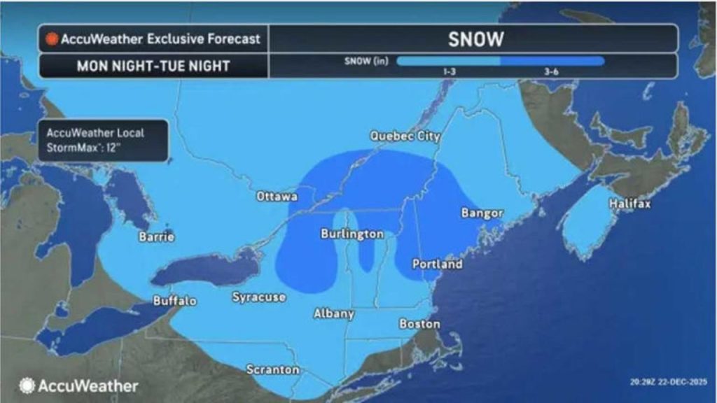
A significant winter storm aimed at the Northeast is expected to unleash a mess of snow, sleet, and ice beginning Christmas night, with AccuWeather’s preliminary snowfall forecasts indicating a widespread 3- to 6-inch accumulation, with some areas seeing up to a foot.
The storm hits as millions of people are due to return home from the holiday, increasing the possibility of airline delays, road closures, and hazardous conditions from Friday, Dec. 26, through early Saturday, Dec. 27.
“A surge of cold, Canadian air will set the stage for a snow and sleet event across the Northeast Friday into Saturday,” AccuWeather Vice President of Forecasting Operations Dan DePodwin said. “When moisture overruns a fresh cold air mass, as in this situation, the stage is set for significant snow and ice, causing widespread travel disruptions.
“Coming right on the heels of the Christmas holiday, this storm comes at a time of higher-than-typical travel and can therefore have a significant impact on flights and car travel.”
Forecasters predict that a wintry combination of snow, sleet, and freezing rain will initially hit northern Minnesota and the eastern Dakotas on Christmas night, then travel southeast through the Great Lakes and Ohio Valley by Friday morning. By Friday afternoon and early evening, the storm will have reached the interior Northeast and northern mid-Atlantic.
Precipitation types by location on Friday, December 26: rain (green), sleet (pink), and snow (blue).
“Significant disruption to road transportation is possible Friday into Saturday across southern New York, Pennsylvania, and New Jersey,” DePodwin said. “Flights across the same area could be delayed or cancelled. This includes the New York City area, which is expected to receive a plowable snowfall.
Snowfall predictions:
- New York City, NY: 3-6 inches
- Long Island, NY: 3-6 inches
- Albany, NY: 3-6 inches
- Hudson Valley, NY: 3-6 inches, with 6-12 inches farther west and north
- Hartford, CT: 3-6 inches
- Northern NJ: 3-6 inches
- Boston, MA: 1-3 inches
- Springfield, MA: 3-6 inches
- Philadelphia, PA: 1-3 inches
- Baltimore, MD: Coating to an inch
- Washington, DC: Coating to an inch
Heavier snow bands may drop 6-12 inches in sections of the Catskill Mountains and around Thunder Bay, Ontario. According to AccuWeather, local totals might exceed 15 inches in certain areas.
Sleet and ice will mix in across southern New York and central Pennsylvania, reducing total snowfall but complicating mobility.
“In New York City, past snow occurrences this winter have not included fresh cold air at the commencement of the snowfall. This has prevented major accumulation in the city proper; however, the outskirts have seen plowable snow. “This storm is unique in that it begins with a lot of cold air,” DePodwin said.
A substantial icing event is also predicted for south-central Michigan and the Allegheny Mountains of Pennsylvania and West Virginia, with up to a quarter-inch of ice likely, enough to damage limbs and cause power outages.