The National Weather Service issued two new winter weather warnings as heavy snowfall and hazardous winds combine to form a powerful winter storm.
“A modest atmospheric river event impacting the Pacific Northwest this evening will advance farther inland through Sunday and Monday into portions of the northern Rockies and also impacting areas as far south as northern California,” the NWS announced on Saturday, Feb. 7.
Heavy rain is forecast in the coastal ranges of Washington, Oregon, and northwest California, while the high terrain of the Cascades and northern Rockies is expected to receive up to two feet of snow.
24 Inches of Snow Coming to 2 States
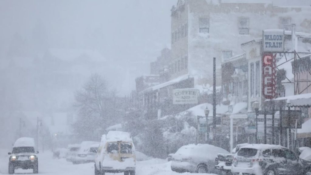
The storm is likely to primarily affect the border between California and Nevada, posing a threat to places like Truckee and Lake Tahoe due to the approaching heavy snow and strong winds.
“Snow accumulations of 10 to 18 inches above 7000 feet. At Lake Tahoe level, 4 to 6 inches, with 6 to 12 inches along and west of Highway 89,” a forecast from the National Weather Service reads. “Wind gusts up to 35 mph, with gusts reaching 70 mph along the Sierra crest. Wave heights 1 to 3 feet on Lake Tahoe.”
The NWS also advised against traveling in the region and issued an additional warning to people with boats or other watercraft in the area.
“Travel could be very difficult. The hazardous conditions could impact the Tuesday morning and evening commutes. Gusty winds could bring down tree branches. Small boats, kayaks and paddle boards will be prone to capsizing and should remain off lake waters until conditions improve,” it said in a statement.
A second storm is likely to slam the area next weekend.