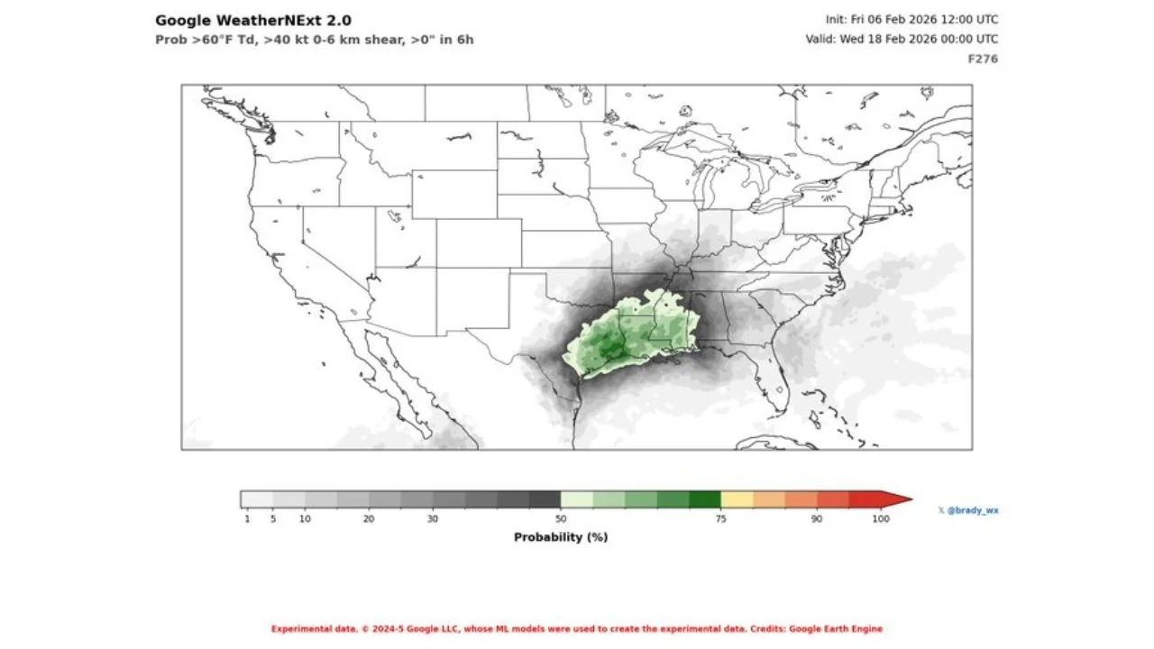
Medium-range forecasts increasingly hint at a more active severe weather pattern forming in the second half of February, with signals intensifying around February 17 throughout parts of the southern Plains and lower Mississippi Valley.
Severe Weather Signal Emerges Around February 17
This Article Includes
Multiple ensemble systems now show a considerable increase in severe weather potential starting in the middle of the month. Although the setup is still a few days away, the consistent direction suggests that we should actively monitor the pattern as February progresses.


The concentration of this signal spans from Texas and Oklahoma eastward into Arkansas, Louisiana, Mississippi, and Alabama, places that climatologically respond swiftly when instability and wind shear coincide at this time of year.
Large-Scale Pattern Supports Storm Development
Forecast height anomaly data show a large trough developing across the western United States, with downstream ridging occurring in the eastern half of the country. This pattern encourages strong southwesterly flow aloft, a key component of organized storm systems in the central and southern United States.
At the same time, temperature anomaly guidance supports above-normal warmth across the South and Midwest, which will contribute to generating a reservoir of low-level instability whenever Gulf moisture returns northward.
Increasing Wind Shear and Moisture Return
Wind field predictions show that mid- and low-level flow will strengthen across the southern Plains and lower Mississippi Valley around February 17. When combined with increased moisture, this configuration favors organized thunderstorms, with the possibility of severe storms if instability develops as predicted.
This overlap of temperature, moisture, and shear is one of the primary reasons forecasters are paying special attention to this period, even with extended lead times.
What to Watch in the Coming Days
As February 17 arrives, forecasters will look for:
- Continued consistency in ensemble trends
- Strength of Gulf moisture return
- Placement of surface boundaries and upper-level disturbances
If the current pattern holds, parts of the southern Plains and Deep South could see their first notable severe weather window of the late winter season.


