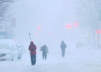
A punishing one-two weather sequence is bearing down on Los Angeles this week: Santa Ana wind gusts of up to 50 mph are forecast to rip valleys and coastal corridors beginning late this week, followed by a rain system that could dump half an inch to an inch throughout the region within 48 hours. The National Weather Service office in Oxnard has already issued a wind alert for many zones in the greater Los Angeles area, and forecasters are tracking a moisture plume that will bring the region’s first significant rainfall in weeks immediately after the winds subside.
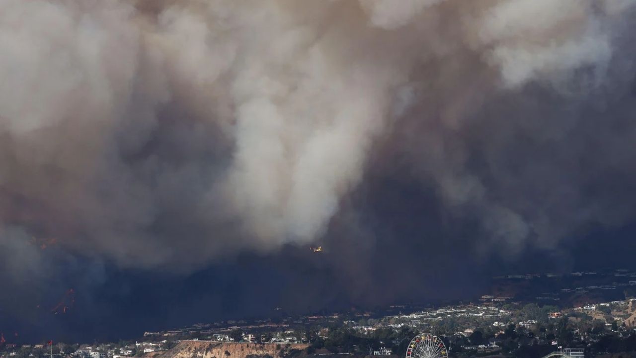
Timing is important. Dry, strong winds will shred leaves, snap branches, and scatter debris along roadways and storm drains. When rain falls before cleanup personnel can catch up, the debris jams the drainage infrastructure, which the city relies on to transport water fast. The rapid transition from fire-weather conditions to wet weather increases the risk of erosion, shallow landslides, and fast-moving debris flows in hillside and canyon communities, particularly those below burn scars from recent wildfires.
Related posts
This Article Includes
- 0.1 Related posts
- 0.2 U.S. Issues Warning For Two States Preparing For Over 8 Feet Waves
- 0.3 Pennsylvania Faces Freeze Warning with Showers and Chance of Snow
- 1 What the National Weather Service is forecasting
- 2 Why this combination is worse than either event alone
- 3 What forecasters are still watching
- 4 What residents can do before the wind and rain arrive


What the National Weather Service is forecasting
The NWS wind advisory predicts steady west winds of 20 to 30 mph, with gusts up to 50 mph, powerful enough to lift unsecured patio furniture, topple shallow-rooted trees, and make high-profile automobiles difficult to operate on exposed freeways and canyon roads. Advisory criteria at this level are based on historical impact data, which means that previous incidents with similar wind speeds caused scattered damage and travel disruptions throughout Southern California.
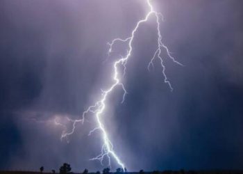
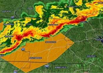
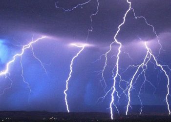
On the rain front, the agency’s forecast discussion predicts half to one inch of precipitation overall, with higher totals in mountain areas where geology pulls air upward and squeezes out extra moisture. Forecasters also warn of thunderstorms with brief heavy downpours, strong winds, and lightning. Even a brief burst of heavy rain in burnt-out terrain can cause flash flooding and send ash-laden runoff rushing downward.
The Weather Prediction Center, the national NWS arm in charge of precipitation forecasts, has classified Southern California as having at least a slight probability of heavy rainfall. Its quantitative precipitation maps, released by the California-Nevada River Forecast Center, confirm that the region is directly in the path of the impending system. A marginal categorization is the lowest tier on the excessive-rainfall scale, but it still indicates that isolated flash flooding may occur where storms stall or track over the same area multiple times.
Why this combination is worse than either event alone
According to the NWS Los Angeles/Oxnard forecast discussion, the present pattern consists of a Santa Ana wind event that transitions into a rain-bearing system within a short time. The risks of each step compound rather than cancel out.
The wind phase dries vegetation, loosens soil on steep slopes, and disperses organic material into gutters and catch basins. If the material remains uncleared before the rain falls, storm drains may back up, leading to water pooling across junctions and underpasses. Hillsides that have already been stressed by wind or weakened by previous fire scarring are more vulnerable to shallow slides as the soil saturates.
For drivers, the sequence is particularly perilous. When the first rain bands arrive, fallen trees and power lines from the windstorm may still litter the roads. Wet pavement atop a film of dust, oil, and leaf litter reduces tire traction more than a regular storm, extending braking distances and increasing the risk of spinout on curves and freeway onramps.
Power outages provide an extra element of disturbance. High winds are a major cause of weather-related outages throughout the Los Angeles basin, and utility technicians frequently cannot safely deploy bucket trucks until gusts fall below operational standards. If rain falls before full restoration is completed, moist conditions slow down repair operations even more, leaving homes, traffic signals, and vital facilities without power for extended periods.
In foothill and canyon neighborhoods, the stakes are higher. Strong winds can destabilize trees and loosen rocks on steep slopes. When it rains, even moderate precipitation can cause debris flows or rockslides to impede narrow roads with little warning. Communities downslope from recent burn scars suffer the greatest risk: burnt soil sheds water rather than absorbing it, directing runoff into fast-moving surges that carry mud, ash, and boulders.
What forecasters are still watching
Several aspects of this projection remain uncertain. The half-to-one-inch rainfall estimate is a regional average; isolated mountain or foothill sites may receive much more if storm cells stall or train along the same track. Without particular stream-gauge forecasts for different LA-area watersheds, it is difficult to determine which creeks and channels pose the highest flood risk. The WPC’s moderate excessive-rainfall classification reflects this uncertainty: forecasters see the potential for localized floods but are unable to justify a formal flood watch.
Thunderstorm activity is inherently difficult to pinpoint. A single cell parked over a burn scar could create debris flows, yet the same storm over a flat metropolitan basin may result in nothing more than minor street flooding. A few miles of storm positioning can determine the difference between a nuisance and an emergency.
The wind forecast also has significant variability. Canyons aligned with the offshore flow may funnel stronger, more turbulent gusts than the advisory headline figure indicates, but sheltered neighborhoods may experience conditions that feel only breezy. Residents find it challenging to assess personal risk based just on regional projections due to the fluctuation.
As of late April 2026, no public statements from emergency management agencies in Los Angeles County, utility companies, or county fire and public works departments had appeared in available NWS products or official county channels confirming whether sandbag distribution sites, burn-scar evacuation advisories, or enhanced storm-drain maintenance schedules were in effect for this event. We based this article on an examination of NWS operational products, without augmenting it with interviews or on-site reporting. Residents should stay tuned to official channels, such as the LA County emergency portal, city websites, and NWS social media feeds, for updates as the event window approaches.
What residents can do before the wind and rain arrive
The practical actions are basic and inexpensive. Before the wind event begins, secure or stow any unsecured outside items such as patio umbrellas, trash cans, or anything else that could become a projectile in 50-mph gusts. During the gusty weather, avoid parking behind huge trees or near aged power poles. Clear leaves and debris from any private-property drains or gutters so that water may flow when it rains.
If you reside in or commute through canyon roads or places with recent burn scars, check for advisories before going out once the rain starts. Keep a phone charger and a torch on hand in case of a prolonged power outage, and prepare alternate routes if your typical commute passes via flood-prone underpasses or small mountain highways.
The same NWS products referenced above will be updated as new model runs and observational data become available. Forecasters change their advice in real time, and the best indication of whether this dynamic sequence will result in a near miss or a genuine interruption will emerge in the final 12 to 24 hours before each phase occurs. Staying connected to those primary sources, rather than relying on secondhand summaries, is the quickest way to prepare for a week that could swiftly shift from breezy and dry to wet and deadly.


