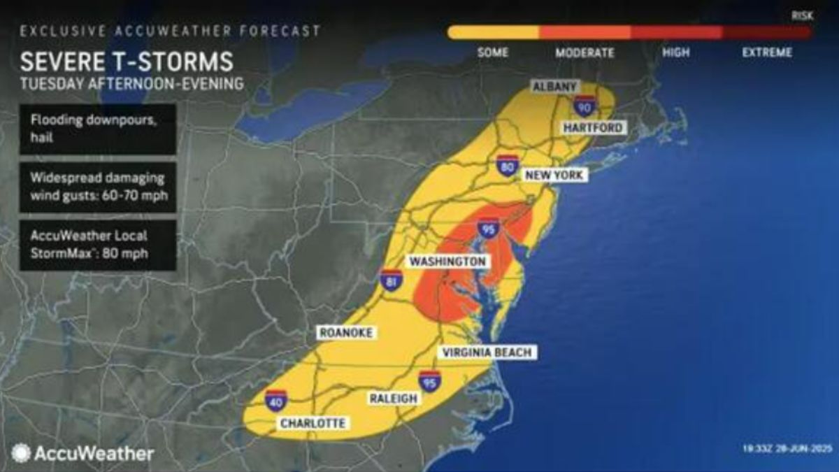
A strong system will bring destructive winds, heavy rain, and thunderstorms to most of the Northeast.
The National Weather Service predicts hot and muggy conditions on Monday, June 30, with highs in the upper 80s to low 90s. Showers and isolated storms are expected to develop across the region by the evening.
Related posts


The real event arrives Tuesday, July 1, when a stronger front approaches from the west. Storms are predicted to develop in the early afternoon and move eastward throughout the region into the evening.
Some locations may experience wind gusts over 60 mph, torrential rainfall, and isolated flooding.
Forecasters predict that the largest dangers will be centered in the orange zones shown on the AccuWeather map above, which include sections of eastern Pennsylvania, New Jersey, and the Hudson Valley.
Conditions should be calm by late Tuesday night. Behind the front, drier air will move in for a period of calmer weather.
Wednesday, July 2, and Thursday, July 3, are forecast to be largely sunny with seasonal temperatures.


