
Back-to-back storm systems may interrupt weekend plans across North Texas, with localized floods, frequent lightning, and strong winds likely until early Monday.
According to the National Weather Service in Fort Worth, the initial storm complex will move southeast into the area tonight and Sunday morning, with a second round expected Sunday night and Monday. While severe storms are improbable, forecasters warn that a single significant wind gust cannot be ruled out during the late Sunday event.
Related posts
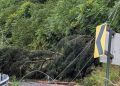

Scattered storms are likely between Graham and Sherman, with isolated activity further south toward Waco and Killeen. The Dallas-Fort Worth metroplex is in the zone for both storm periods, raising the possibility of numerous hits. The main worries are water pooling on highways, lightning disturbing outdoor events, and occasional wind gusts strong enough to bring down minor limbs or power lines.
Residents are encouraged to watch local notifications and be prepared to change their outdoor plans, especially Sunday evening and early Monday. Flash flooding is still a problem in low-lying and poorly drained areas.
Additional advisories may be issued if storms intensify or move southward into central Texas.


