Thursday, March 12, 2026
  • Terms and conditions
  • Disclaimer
  • DMCA Policy
  • Cookie Policy
RHS News
  • U.S. News
  • Washington News
    • Kennewick News
    • Seattle News
    • Spokane News
    • Tacoma News
    • Vancouver News
    • Yakima News
  • Politics
  • Sports
  • Weather
  • Finance
  • Contact Us
No Result
View All Result
RHS News
Home Weather

New York & Pennsylvania Weather Alert: Clipper System Arrives Sunday, Brings Snow Chances

by Paige Wuthrich
November 22, 2025
in Weather
New York & Pennsylvania Weather Alert: Clipper System Arrives Sunday, Brings Snow Chances

A minor low-pressure system is likely to pass just south of the region tonight, bringing light rain to parts of northeastern Pennsylvania, according to the National Weather Service in Binghamton. The rest of Central New York will remain fairly dry until a second system hits late this weekend.

According to the National Weather Service, temperatures in the region will be in the upper 30s to low 40s tonight, with significantly cooler readings at higher elevations. Montrose, Scranton, and Wilkes-Barre may have moderate precipitation overnight, but communities in Central New York—including Binghamton, Cortland, Oneonta, and Ithaca—remain generally dry.

Related posts

This Article Includes

  • 1 Related posts
  • 2 NWS Warns of Tornado Risk Tonight Across 4 Major U.S. States
  • 3 Pennsylvania Weather Alert: Heavy Snow Could Return to Philadelphia & Pittsburgh March 15–21
NWS Warns of Tornado Risk Tonight Across 4 Major U.S. States

NWS Warns of Tornado Risk Tonight Across 4 Major U.S. States

March 11, 2026
Pennsylvania Weather Alert: Heavy Snow Could Return to Philadelphia & Pittsburgh March 15–21

Pennsylvania Weather Alert: Heavy Snow Could Return to Philadelphia & Pittsburgh March 15–21

March 10, 2026

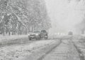
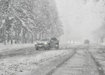
Forecasters said emphasis will shift to Sunday, when a weak front and clipper system will pass just north of the region. This system may bring sporadic rain or snow showers, especially late in the morning and afternoon. While accumulation is not forecast, passing showers may result in minor visibility losses and wet roads.

The probability of precipitation rises to 40-60 percent for numerous regions on Sunday, including Syracuse, Cortland, Norwich, and Binghamton, before tapering off Sunday night. Temperatures will stay seasonably cool throughout the weekend, with highs in the upper 30s to mid-40s and nighttime lows in the upper 20s and low 30s across much of the Southern Tier and Central New York.

The workweek begins chilly on Monday as a secondary cold front sweeps in, dropping temperatures into the mid-30s to low 40s with persisting low-end precipitation possibilities.

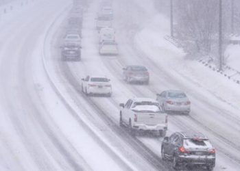
Drivers should be wary of shifting weather conditions throughout the weekend, particularly early Sunday, when mixed precipitation is more likely.

ShareTweetPin
Previous Post

3 Indicted In Connection With The Seizure Of Approximately 99 Kilos Of Cocaine In Massachusetts, New York And Puerto Rico

Next Post

Heartland Thanksgiving Weekend Weather Alert: Arctic Blast and Snow Threat for Kansas, Nebraska & Missouri

Paige Wuthrich

Paige Wuthrich

Related Posts

NWS Warns of Tornado Risk Tonight Across 4 Major U.S. States
Weather

NWS Warns of Tornado Risk Tonight Across 4 Major U.S. States

March 11, 2026
Pennsylvania Weather Alert: Heavy Snow Could Return to Philadelphia & Pittsburgh March 15–21
Weather

Pennsylvania Weather Alert: Heavy Snow Could Return to Philadelphia & Pittsburgh March 15–21

March 10, 2026
Mid-Atlantic Winter Alert: Heavy Snow Could Slam Pennsylvania–New Jersey I-95 Corridor March 15–21
Weather

Mid-Atlantic Winter Alert: Heavy Snow Could Slam Pennsylvania–New Jersey I-95 Corridor March 15–21

March 9, 2026
South Carolina Weather Alert: Snow or Freezing Rain Possible in Columbia and Greenville March 15–21
Weather

South Carolina Weather Alert: Snow or Freezing Rain Possible in Columbia and Greenville March 15–21

March 9, 2026
Heavy Snow Warning Issued With Up to 14 Inches Set to Hit
Weather

Heavy Snow Warning Issued With Up to 14 Inches Set to Hit

March 7, 2026
Millions Prepare For 80 Mph Winds & Tornadoes, Hen-egg-sized Hail On Friday
Weather

Millions Prepare For 80 Mph Winds & Tornadoes, Hen-egg-sized Hail On Friday

March 6, 2026
Next Post
Heartland Thanksgiving Weekend Weather Alert: Arctic Blast and Snow Threat for Kansas, Nebraska & Missouri

Heartland Thanksgiving Weekend Weather Alert: Arctic Blast and Snow Threat for Kansas, Nebraska & Missouri

Leave a Reply Cancel reply

Your email address will not be published. Required fields are marked *

BROWSE BY CATEGORIES

  • Accident
  • Crime
  • Finance
  • Kennewick News
  • Missing Person
  • Politics
  • Tacoma News
  • U.S. News
  • Washington News
  • Weather

Recent News

  • Missing 7-Year-Old Pearland Girl Found Dead After Amber Alert
  • Montgomery County Detectives Find Missing Minor And Apprehend 2 Women For Child Trafficking
  • 2 Southern California brothers Detained in $5.8M insurance fraud scheme
  • Springfield man sentenced to prison after guilty plea in case involving 3 children
  • Mattapan store owner pleads guilty in $6.7 Million SNAP fraud scheme

Category

  • Accident
  • Crime
  • Finance
  • Kennewick News
  • Missing Person
  • Politics
  • Tacoma News
  • U.S. News
  • Washington News
  • Weather

Important Pages

  • About Us
  • Contact Us
  • Cookie Policy
  • Disclaimer
  • DMCA Policy
  • Editorial Policy
  • Fact-Checking Policy
  • Privacy Policy
  • Terms and conditions
No Result
View All Result
  • U.S. News
  • Washington News
    • Kennewick News
    • Seattle News
    • Spokane News
    • Tacoma News
    • Vancouver News
    • Yakima News
  • Politics
  • Sports
  • Weather
  • Finance
  • Contact Us

© 2025 RhsNews.Co

Go to mobile version