Forecasters warn that another powerful seiche event is developing on Lake Erie, with early forecasts indicating circumstances that could approach November’s huge episode, one of the largest in years. Water levels around Toledo are predicted to dip approximately 4 feet below the low water datum, indicating a substantial flow of water from the western basin to the lake’s eastern side.
Water Levels Expected to Plunge Near Toledo
This Article Includes
According to early projections, high winds will carry the water eastward Thursday night and Friday morning. This rapid shift may result in dangerously low water levels throughout the western basin, including Toledo and surrounding coastal cities.


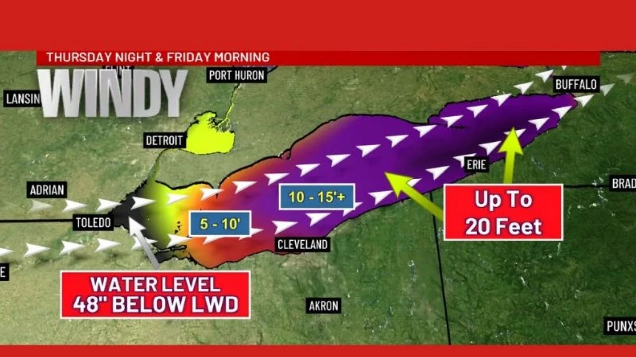
The predicted graphic depicts water levels dropping 48 inches below LWD, exposing coastal structures, creating dangerous navigation conditions, and fast-shifting water masses throughout the lake.
Waves of 15–20 Feet Possible in Eastern Lake Erie
As the water rushes east, the ensuing rise may cause severe wave heights in regions downwind. The projections indicate:
- 5–10 foot waves developing from Toledo to Cleveland
- 10–15+ foot waves extending toward Erie
- Up to 20-foot waves possible near Buffalo and the eastern basin
These massive waves might have an impact on waterfront roads, lakeside homes, breakwalls, and marinas in Ohio, Pennsylvania, and New York.
Timing: Thursday Night Into Friday Morning
Meteorologists underline that the peak window for this storm appears to be late Thursday into early Friday, while the timeline will be refined as more data becomes available.
Residents in coastline communities in Ohio, Michigan, Pennsylvania, and western New York should be aware of government alerts, secure unsecured things, and prepare for rapidly changing water levels and powerful wave action.


