A new round of wintry weather is on its way, with three fast-moving storm systems expected to produce more snow and treacherous conditions over the weekend and into early next week.
According to AccuWeather, the parade of clipper storms and freezing Canadian air isn’t stopping, causing issues for travelers from the Great Lakes to the Northeast.
Related posts


The most recent clipper system left the Northeast on Friday, January 2, and another is already on its way. This fast-moving storm is predicted to produce light snow in much of New York, New Jersey, Pennsylvania, Connecticut, Massachusetts, and northern New England on Saturday night, Jan. 3, primarily after midnight and into early Sunday, Jan. 4.
This pattern is likely to continue into early next week, just in time for many people’s first day back at work and school on Monday, January 5.
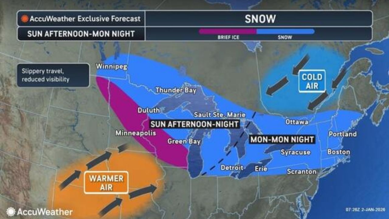
The first batch of snow is forecast to fall from the Great Lakes to parts of New York, northern Pennsylvania, northern New Jersey, and New England on Saturday and Saturday night, January 3.
A larger, slightly heavier bout of precipitation is expected to arrive Sunday afternoon, Jan. 4, and last into Monday morning. This could deliver enough snow to northern Pennsylvania, central New York, and New England, resulting in another round of slick travel.
As slightly warmer air moves in late Sunday, Jan. 4 into Monday, Jan. 5, snow is predicted across much of New York, northern New Jersey, and Pennsylvania, as well as New England, with freezing rain further south.
“There will be enough snow to make for a new round of slippery roads,” AccuWeather Meteorologist Alyssa Glenny said.
She also warned that as warmer air comes in midweek, any afternoon melting may refreeze overnight, posing risks to both pedestrians and automobiles.


