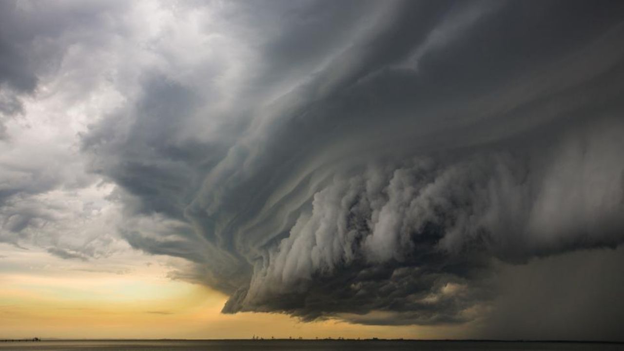
Millions of Americans in eight states are prepared for a hazardous storm system that could bring 80 mph wind gusts, tornadoes, and large hail this Friday. The severe weather is expected to cause significant damage to the impacted areas, and inhabitants are warned to watch circumstances closely, as they may need to take shelter or evacuate depending on the severity of the storm’s impact.
Where 80 Mph Wind Gusts, Tornadoes, and Huge Hail Could Hit Friday
This Article Includes
Fox Weather reported on a weather system whose effects began on Wednesday but would get substantially more severe on Friday. According to the publication, the multi-day storm affected “millions” of people in Texas, Oklahoma, Kansas, Missouri, and Arkansas. Furthermore, an AccuWeather forecast that mentions Texas, Kansas, and Missouri broadens the reach to encompass sections of Nebraska, Illinois, and Indiana. Both publications agree on one point: the storms will have severe consequences.


According to an AccuWeather Local StormMax forecast, the system could produce 80 mph wind gusts and tornadoes. The National Severe Storms Laboratory of the National Oceanic and Atmospheric Administration depicts the devastation caused by 80 mph winds in stunning detail. It observes that speeds of 50-60 mph are already classified as harmful; however, the type of speed that this technology may bring, which could reach up to 80 mph, may pose major concerns, especially to certain people’s homes, particularly those in vulnerable areas or with inadequate structural support.
“People living in mobile homes are especially at risk for injury and death. Even anchored mobile homes can be seriously damaged when winds gust over 80 mph.” The agency’s website featured a photo of a mobile home that had been pushed over on its side alongside that quote, which perfectly illustrates the potential danger.
Both AccuWeather and Fox Weather predict significant hail as part of this cyclone. However, Matthew Cappucci, senior meteorologist at MyRadar Weather Radar, provided a detailed image of the projected hail size. He projected that Friday’s hail might be “up to hen egg size.”
Capucci also stated that the circumstances predicted for Friday “could feature the season’s first widespread severe weather threat along I-35 in classic ‘Tornado Alley.'” He encouraged individuals in the impacted area who planned to travel that day to regularly follow weather forecasts to ensure their safety, since the risk could linger until Friday night.


